Did you know that recent weighbridge operations across the country have found nearly 23% of vehicles are currently overloaded? It is a sobering reality for those of us dreaming of the red dust and wide-open horizons of the interior. This remote Australia trip planning guide is designed to keep you on the right side of the law and the safe side of the track. We understand the anxiety that comes with clicking through endless gear reviews or worrying about a mechanical failure when you are three days from the nearest settlement. Between the updated 2026 permit requirements for remote areas and diesel hitting A$2.21 per litre in outback locations, the stakes for a successful expedition have never been higher.
We believe that responsible exploration starts with a solid foundation of self-reliance and environmental respect. By following this framework, you will learn how to integrate your vehicle, high-tech satellite gear like the new A$500 Garmin inReach Mini 3 Plus, and sustainable route planning into one cohesive system. We are going to walk you through a professional logistics plan that ensures your gear is ready, your permits are sorted, and your impact on our beautiful outback is minimal. It is time to prepare your setup for the rugged paths ahead.
Key Takeaways
- Master a strategic framework for managing fuel, water, and recovery logistics to handle the unpopulated Australian interior with confidence.
- Align your vehicle’s Gross Vehicle Mass (GVM) with your specific terrain goals to ensure your setup is both legal and capable.
- Use this remote Australia trip planning guide to harness the 2026 tech stack, including Starlink Mini and high-resolution satellite imagery for reliable off-grid safety.
- Implement a five-step route architecture that includes seasonal validation and precise fuel mapping to identify your point of no return on every leg.
- Access real-time track reports and gear troubleshooting through the Adventurerz community to stay ahead of rapidly changing outback conditions.
What is a Remote Australia Travel Planner and Why You Need One in 2026
Think of a remote travel planner as your mission control. It is a strategic framework that keeps your rig moving and your crew safe. While some basic guides just point to pretty views, this remote Australia trip planning guide prioritises your life support systems: fuel, water, and communications. 2026 demands this level of precision. We have seen a rapid shift toward digital-only permit systems across the Northern Territory and Western Australia. Climate patterns are also swinging more wildly, making old seasonal data less reliable than it once was. You need to pivot from being a passive tourist to an active explorer. This means taking full accountability for your preparation and your impact on the land.
We live by one non-negotiable standard: the Golden Rule of 48 hours. You must be equipped to handle 48 hours of total isolation without any outside assistance. If a CV joint snaps or a flash flood cuts the track, you shouldn’t be reaching for an SOS button as your first move. You should be reaching for your toolkit and your water reserves. Our community values self-reliance because it preserves emergency resources for those in truly life-threatening situations. Preparation is the bridge between a dangerous situation and a great story told around the campfire.
The Reality of Distance and Isolation
Visualising the scale of The Australian Outback is difficult until you are in the thick of it. We are talking about stretches of track where the nearest basic service is 600 kilometres away. This creates a psychological shift. You can’t rely on a quick tow or a mobile signal. We often enter “Black Zones” where traditional tools like Google Maps fail entirely. You need offline topographic maps and a mindset that embraces total self-reliance. When the horizon doesn’t change for hours, your planning is what keeps the isolation from becoming overwhelming.
Sustainability as a Planning Core
Responsible exploration is at the heart of everything we do. The 2026 Leave No Trace standard is higher than ever. We don’t just pack out our trash; we manage greywater and human waste to protect sensitive, arid ecosystems. Respecting Indigenous lands is also a legal and ethical pillar. Many tracks, like the Central Arnhem Highway, require specific transit permits from the Northern Land Council. Integrating these permit timelines into your initial route plan is essential. For example, a 3-day visitor pass for Dhimurru Recreation Areas costs A$39.00 and must be secured before you arrive. If you are setting up camp, using gear like high-quality roof top tents can help you stay off the ground and minimize your footprint on fragile desert crusts.
The Gear-First Philosophy: Mapping Your Vehicle Setup to the Terrain
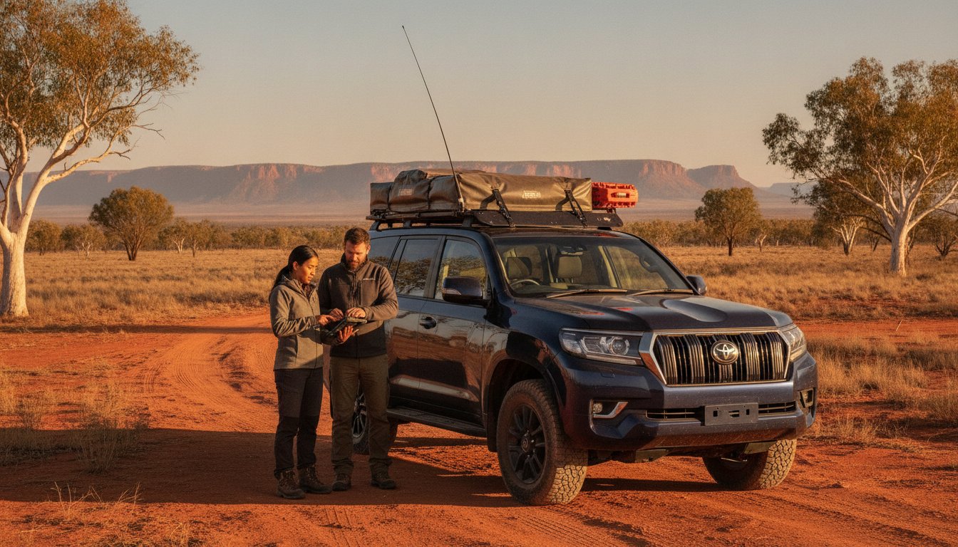
We often see travelers pick a destination on a map before they even look at their rig. In our community, we flip that. Your gear list isn’t just a packing manifest; it’s your primary itinerary constraint. If your setup can’t handle deep sand or corrugated tracks for a week, then the Simpson Desert is off the table for now. This remote Australia trip planning guide emphasizes that your vehicle’s Gross Vehicle Mass (GVM) is the most critical number you’ll ever track. Recent weighbridge operations by Victoria Police found a 23% failure rate for overloaded vehicles. Overloading isn’t just a safety risk; it’s a legal one that can void your insurance in the event of a claim. Following established Outback safety guidelines means knowing exactly what your vehicle weighs when fully loaded with fuel, water, and recovery gear.
High-quality recovery gear is your insurance policy against the unpredictable. We don’t just carry a snatch strap and hope for the best. We plan our routes based on our ability to self-recover. If you are traveling solo, a winch and sand tracks are mandatory. Your choice of shelter also dictates your mobility. A setup that takes an hour to pack down will discourage you from moving to that next hidden gorge. We prioritize efficiency so we can spend more time exploring and less time wrestling with tent poles.
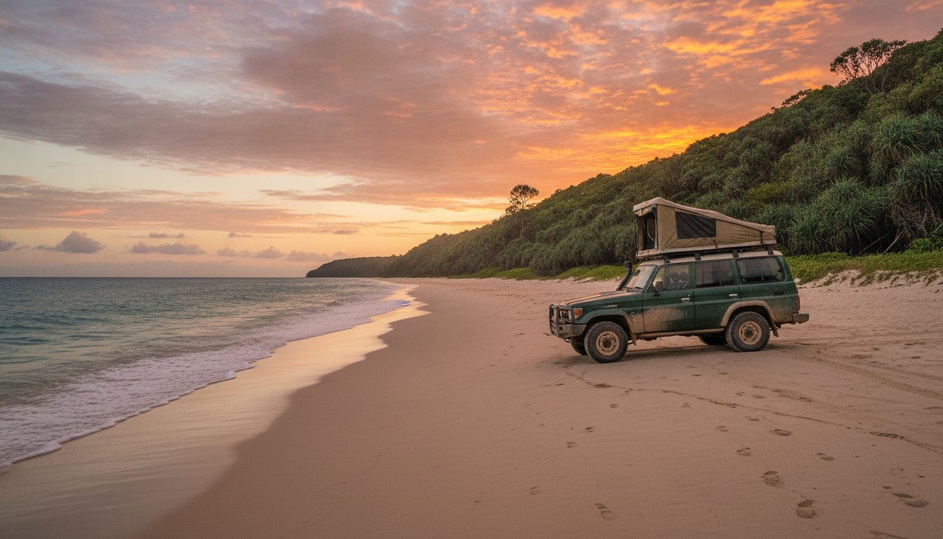
Shelter Systems: Rooftop Tents vs. Ground Camping
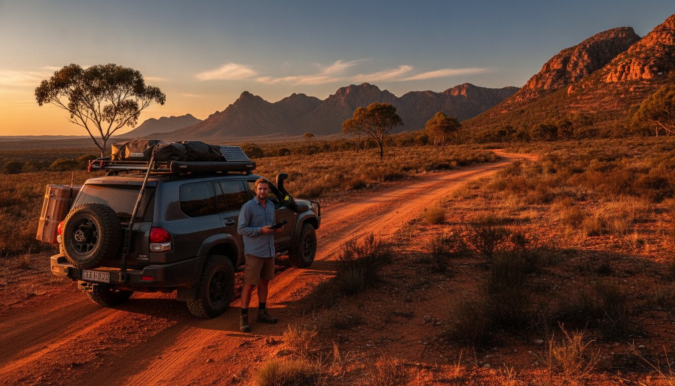
We love the speed of rooftop tents for those long hauls across the interior. They keep you off the sharp spinifex and away from curious wildlife. However, you must consider weight distribution. A heavy hardshell tent sitting high on your roof rack changes your centre of gravity. This affects how your 4WD handles on off-camber tracks. Hardshells offer superior durability against the relentless Australian dust and wind, while softshell versions often save on precious kilograms. If you’re still deciding on the best way to sleep under the stars, you can find a breakdown of the best rooftop tents to find a match for your specific GVM limits.
Self-Sustaining Power and Water
Living off-grid in 2026 means moving toward lightweight lithium setups paired with portable solar blankets. These provide the high-draw power needed for 12V fridges and satellite units without the massive weight penalty of old AGM batteries. Water logistics are even more vital. We plan for 5 to 7 litres per person per day in arid zones. We also use the Redundancy Rule: every critical system needs a manual backup. If your digital battery monitor fails, you should have a basic voltmeter. This methodical approach ensures your gear supports your adventure rather than hindering it.
The 2026 Tech Stack: Advanced Navigation and Communication Safety
The days of relying on a single GPS unit or a basic phone app are long gone. In 2026, we have moved toward high-resolution satellite imagery that lets us see the actual track surface before we even air down. This level of detail is a core part of any modern remote Australia trip planning guide. The Starlink Mini has changed the game for us, providing high-speed connectivity even in the deepest parts of the Gibson Desert. This isn’t just about streaming at camp. It is about accessing real-time Bureau of Meteorology radar and downloading updated track files when a storm rolls in unexpectedly. Connectivity equals safety.
We utilize a Triple Threat safety stack to ensure we are never truly lost. This includes a dedicated Personal Locator Beacon (PLB), a two-way satellite messenger, and a set of high-quality paper maps. While the new Garmin inReach Mini 3 Plus (A$500) is a fantastic tool for sending photos and voice memos via satellite, it shouldn’t be your only lifeline. We always back it up with a subscription-free device like the ACR rescueME PLB1 (A$395) for life-threatening emergencies. Under the current 2026 ACMA regulations, all UHF radio users must keep channels 5 and 35 clear for emergency distress calls only.
Mapping the Unmapped
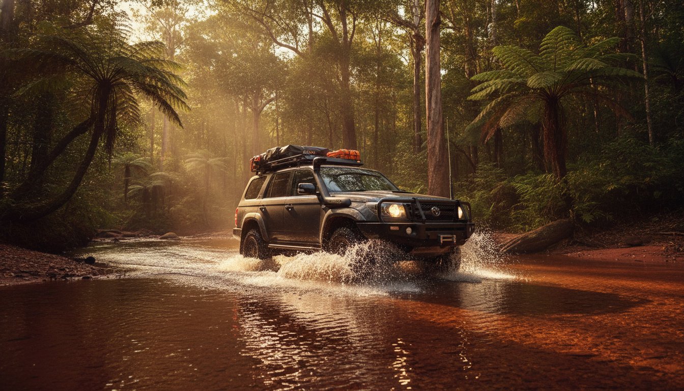
Road maps are fine for the blacktop, but once you hit the dirt, you need topographic data. These maps show elevation changes, creek crossings, and watercourses that road maps ignore. We always pre-load our offline data using 2026 planning apps while we still have high-speed home internet. Don’t wait until you’re at the trailhead to download gigabytes of imagery. We also lean heavily on community-sourced Live Track data. This allows our fellow explorers to report washouts, deep corrugations, or fallen trees in real-time, helping us avoid dangerous dead-ends and wasted fuel.
Critical Communication Protocols
We never head out without setting a Snail Trail. This is a digital itinerary shared with a trusted contact who knows exactly when to raise the alarm if we don’t check in. It is also vital to know your equipment. An EPIRB is generally larger and designed for maritime use, while a PLB is a compact, land-based device meant to be carried on your person. When you stop to send your nightly “all clear” message, having one of the best 4wd awnings set up provides a shaded, comfortable hub to manage your tech stack and review the next day’s route. This methodical approach keeps the stress low and the adventure high.
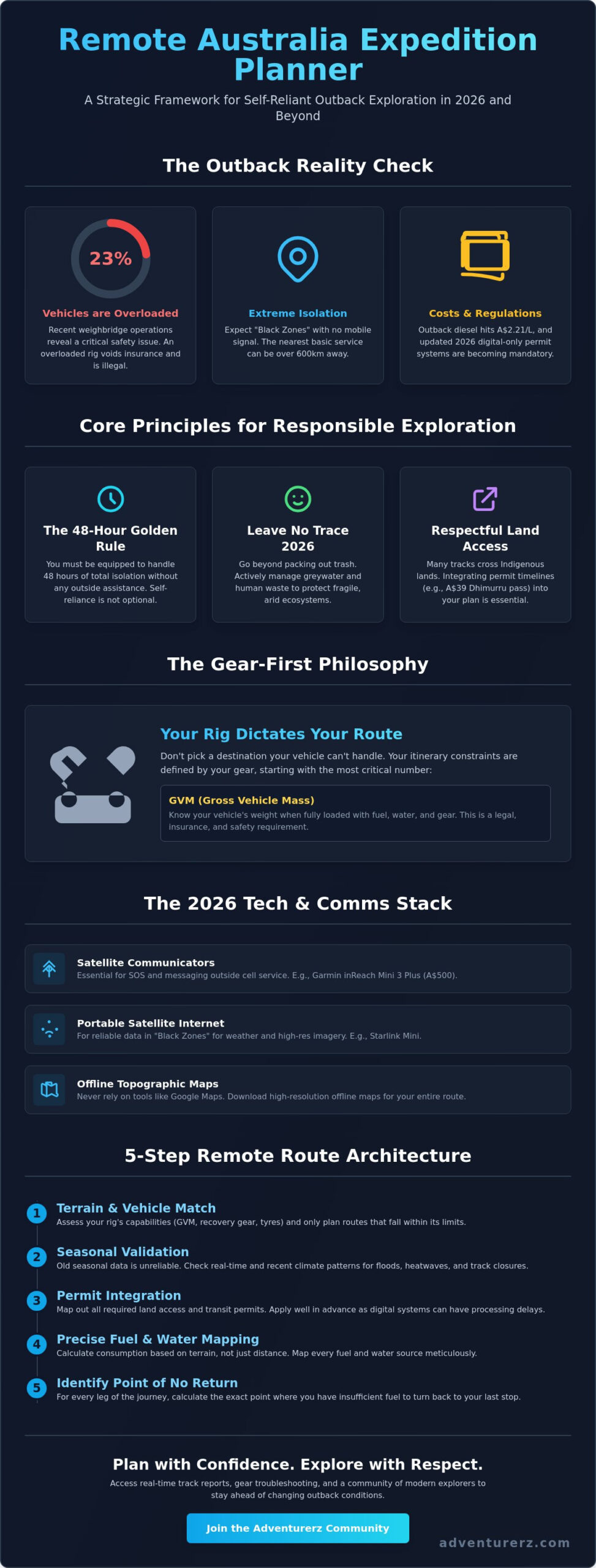
The 5-Step Remote Route Architecture: Building Your 2026 Itinerary
We don’t just “go” to the outback; we architect a journey that respects the land and our own safety. A successful expedition relies on a blueprint that accounts for every variable before the tyres hit the gravel. This remote Australia trip planning guide uses a five-step architecture to ensure no detail is left to chance. We start with Step 1: Seasonal Validation. In 2026, we are seeing more unpredictable weather patterns, so matching your route to the latest climate forecasts is non-negotiable. Step 2: Fuel Mapping involves identifying your “Point of No Return” for every leg, ensuring you always have a 20% reserve. Step 3: Permit Procurement is now almost entirely digital. Whether you need a free Transit Permit for the Great Central Road or a Visitor Access Permit for Arnhem Land, these must be secured weeks in advance. Step 4: The What-If Layer builds in alternative routes for when a track is washed out. Finally, Step 5: Final Weight Check ensures your rig isn’t part of the 23% of vehicles found to be dangerously overloaded in recent roadside checks.
Timing the Trip: Seasonal Hazards
Northern Australia requires a completely different logistical logic depending on the season. During the Wet, tracks that were bone-dry in August become impassable rivers. We plan our travel times to avoid midday temperature peaks, which can easily soar into the mid-40s in the interior. This protects our engines from overheating and keeps our crew from heat exhaustion. If you are planning a long-haul desert crossing, check our guides on roof top tents to ensure your sleeping setup offers enough ventilation for those humid tropical nights or freezing desert evenings.
Fuel and Provisioning Strategy
Calculating fuel range for low-range 4WDing is very different from standard highway touring. We often see consumption double when pushing through deep sand or heavy mud. You also need to budget for the “Remote Surcharge.” With regional diesel prices averaging A$2.21 per litre in 2026, a single fill-up at a remote station can be a significant expense. Bulk provisioning is our secret to staying out longer. We pack and store food for at least 14 days, focusing on high-energy, shelf-stable ingredients that don’t rely solely on a 12V fridge. Check out our expert reviews on the best 4wd awnings to ensure your mobile basecamp has a shaded area for organizing your supplies and preparing meals away from the midday sun.
Community-Led Exploration: The Adventurerz Advantage for Modern Explorers
Static paper guides are a relic of the past. In the outback, a track that was clear at breakfast can become a treacherous bog by sunset. This is why a truly effective remote Australia trip planning guide must be a living, breathing resource. We don’t just rely on old data; we rely on each other. Our community provides a real-time feedback loop that static itineraries simply cannot match. When one of our Adventurerz encounters a new washout on the Oodnadatta Track or a broken pump at a remote station, they share that intel immediately. This collective knowledge is what keeps us moving forward while others are stuck waiting for a recovery truck that might be days away.
We also champion the Mentor Model. If you are preparing for your first deep-desert crossing, you don’t have to guess your way through the preparation. We connect aspiring explorers with seasoned veterans who have navigated the most challenging corners of the continent. These mentors offer invaluable advice on gear troubleshooting and route refinement. Once you are out there, we encourage you to document your 2026 journey. By sharing your own track reports and photos, you contribute to the safety and success of every explorer who follows in your tyre tracks. We are all guardians of this rugged landscape and each other.
Real-Time Intelligence
User-contributed data is our most powerful tool! Accessing a photo of a creek crossing taken only 24 hours ago allows us to judge depths and flow rates with incredible accuracy. We also lean heavily on expert gear reviews within the community to avoid equipment failure in the wild. We know which setups survive the relentless corrugations and which ones fall apart. After you have successfully navigated the red dust and isolated tracks, you might be ready for some civilization. Check our 2026 Guide to Adventure & Luxury for an end-of-trip reward that offers a bit of comfort after weeks of self-reliance.
The Future of Remote Travel
We are committed to advocating for sustainable and ethical access to Australia’s remote natural wonders. As Adventurerz, we lead by example, showing that high-energy exploration can coexist with deep environmental respect. We have an exciting lineup of community meetups and remote workshops scheduled throughout 2026. These events are designed to sharpen your recovery skills and deepen your understanding of the ecosystems we travel through. It is time to stop dreaming about the horizon and start reaching for it. Join the Adventurerz community and start your 2026 planning today!
Secure Your Setup and Chase the Horizon
Navigating the wild in 2026 requires more than just a sense of adventure; it demands a professional framework for logistics and safety. We have walked through the essential integration of vehicle GVM compliance, advanced satellite communication, and the shifting digital permit landscape. This remote Australia trip planning guide is your blueprint for a self-reliant expedition that respects both the environment and the traditional owners of the land. By moving from a tourist mindset to that of a methodical explorer, you ensure that every track leads to a safe and rewarding discovery.
Our community stands ready to help you refine your mission. We provide expert-vetted gear reviews and community-driven track updates to keep your rig moving through the toughest conditions. We are dedicated to sustainable and ethical exploration, ensuring these remote regions remain pristine for years to come. Plan your 2026 remote escape with Adventurerz expert guides and join a fellowship of explorers who value durability and heritage. The outback doesn’t wait for the unprepared. It’s time to air down and head out!
Frequently Asked Questions
What is the best remote Australia travel planner for 2026?
The most effective planning framework for 2026 is a system-of-systems approach that integrates vehicle GVM limits, digital satellite technology, and community-led track intelligence. We recommend a strategy that moves beyond static itineraries to include real-time data on track washouts and fuel availability. By combining a professional logistics framework with the shared expertise of the Adventurerz community, you create a plan that is resilient enough to handle the unpredictable nature of the Australian interior.
Do I really need a satellite phone for remote Australian travel?
You don’t necessarily need a dedicated satellite phone, but a two-way satellite messenger is a mandatory component of any modern remote Australia trip planning guide. These devices allow you to send check-in texts to family, receive updated weather forecasts, and communicate with emergency services without the high cost of a satellite voice plan. While a PLB is vital for life-threatening situations, the ability to message a mentor about a mechanical issue provides a significant safety buffer.
How much fuel should I carry for a remote 4WD trip?
We always carry enough fuel to cover our longest planned leg at worst-case consumption rates, plus a 25% safety reserve. It is a mistake to rely on highway fuel figures when you are pushing through deep sand or heavy mud, as your consumption can easily double. We identify the “Point of No Return” for every track leg. If you haven’t reached your halfway mark with more than 60% of your fuel remaining, the safest move is to turn back.
What are the most important permits for remote Australia in 2026?
The most critical permits include Indigenous land transit permits and state-specific digital park passes. In 2026, most jurisdictions have moved to digital-only systems, meaning you must secure your documentation while you still have high-speed reception. Traveling through many Aboriginal lands is a legal requirement that requires formal permission from Land Councils. This process ensures you are respecting traditional ownership and staying updated on local rules or temporary closures that might affect your route.
Can I use a standard SUV for remote Australian travel?
A standard soft-roader SUV is generally not suitable for truly remote outback tracks. These environments require high ground clearance, a dual-range transfer case for low-range crawling, and light truck (LT) rated tyres to survive sharp rocks and heat. While a standard SUV might manage graded gravel roads, it lacks the structural durability and recovery points needed for self-reliance in isolated zones. We always advocate for a dedicated 4WD platform to ensure you don’t become a liability to other travelers.
How do I find reliable water sources in the Outback?
The golden rule of remote travel is to never rely on finding water in the wild. You must carry a minimum of 5 to 7 litres per person per day for the duration of your trip, plus a two-day emergency reserve. While some cattle stations or remote communities may have bores, the water is often highly mineralised or unsuitable for drinking. We treat any natural water source as a bonus rather than a primary supply, and we always use high-quality filtration systems.
What is the best time of year to plan a remote Australian road trip?
The cooler months between May and August are the ideal window for exploring the Australian interior. During this time, daytime temperatures are manageable, and the extreme heat that can push past 45 degrees Celsius in the summer is avoided. If you are heading into northern regions, this period also coincides with the Dry Season. This ensures that major tracks are generally open and creek crossings have dropped to safe levels, allowing your vehicle setup to perform at its best.
How do I manage emergency medical situations in isolated areas?
Managing a medical emergency in the outback requires a comprehensive remote first aid kit and a reliable way to contact the Royal Flying Doctor Service. Because help can be days away, we focus on stabilization and clear communication via satellite SOS devices. You should always leave a detailed digital itinerary with a trusted contact who can provide your exact coordinates to emergency services. Preparation and first aid training are your best tools when you are beyond the reach of an ambulance.