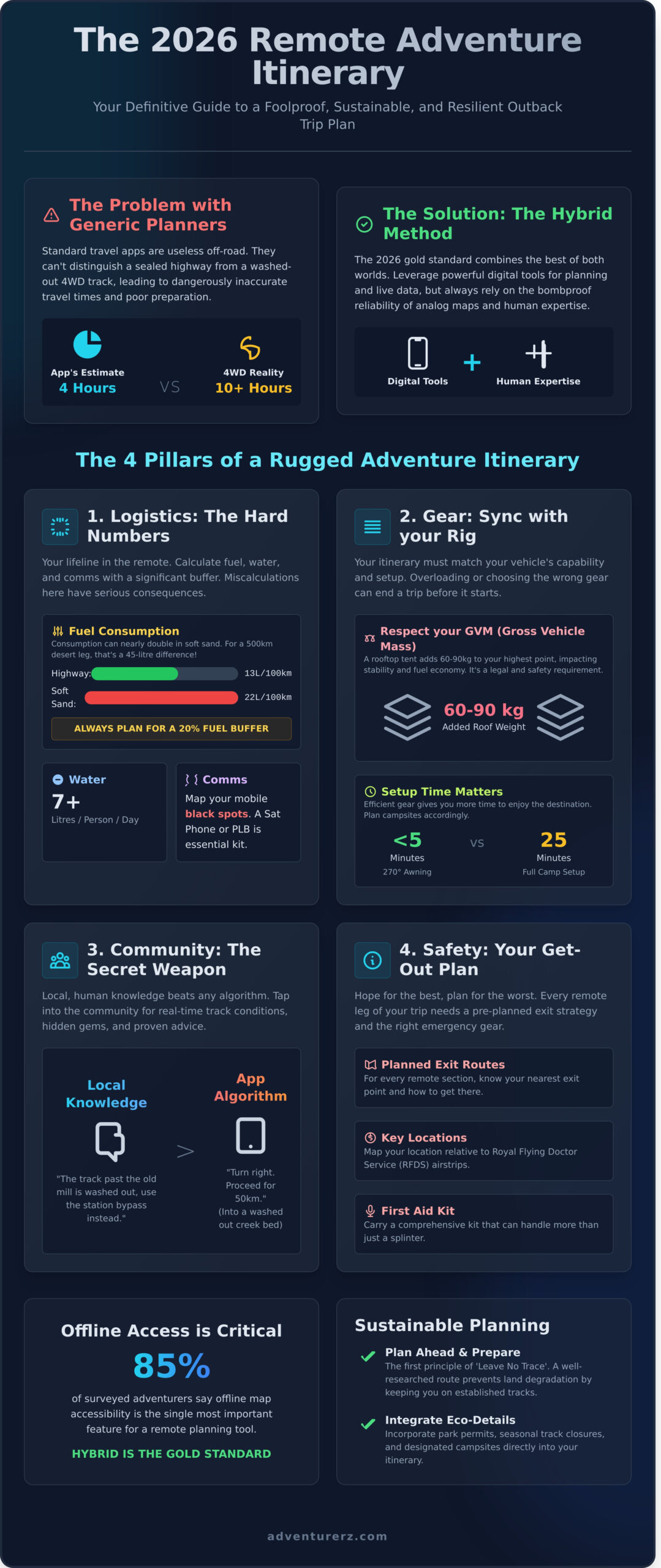
That slick travel app on your phone? It’s completely useless in the outback!
We’ve all felt that frustration. You’re plotting a course across the Kimberley, and the app gives you a travel time that would only be possible in a helicopter. These generic planners just don’t understand the difference between a sealed highway and a washed-out 4WD track that’ll rattle your fillings loose. It’s a recipe for disaster and can leave you seriously under-prepared when you’re a long way from anywhere.
Well, it’s time to take back control! This is your definitive guide to becoming a master itinerary planner for the kind of rugged, off-grid Aussie adventures we live for. We’re going to equip you with the absolute best digital tools and expert human insights to build a trip plan that is not only foolproof and shareable but also deeply sustainable.
Get ready to dive into our framework for 2026, so you can craft an adventure plan that gives you total confidence in your gear and ensures you leave nothing but tyre tracks.
Key Takeaways
- Learn why modern remote adventure plans must blend digital tools with essential bushcraft to be truly resilient out on the tracks.
- Master the art of mapping critical logistics like fuel range, water sources, and communication black spots to avoid getting caught out.
- Discover which digital itinerary planner is best for rugged Aussie conditions and, more importantly, when to trust human expertise over an app.
- Build a genuinely sustainable 4WD trip by calculating your ‘Remote Radius’ and layering your maps with eco-friendly campsites.
Why Your 2026 Itinerary Planner Needs to Be More Than a List
Let’s be honest, the old way of trip planning is dead. A simple list of towns scribbled on a napkin just doesn’t cut it anymore. For today’s Adventurerz, the modern itinerary is a living, breathing document. It’s a powerful blend of cutting-edge tech and time-tested bushcraft, designed for a new era of exploration. As we look toward 2026, the shift is clear: we’re all moving towards high-detail, sustainable adventure planning that respects the land we love to explore.
This isn’t just about logistics; it’s about confidence. A meticulously crafted plan is the ultimate antidote to ‘remote-travel anxiety’. Knowing your fuel stops, water sources, and contingency campsites before you even turn the key transforms pre-trip jitters into pure, unadulterated excitement. It’s the difference between worrying about the unknown and embracing it. Generic apps are fantastic for navigating Collins Street, but they often fail spectacularly the moment the bitumen ends and the real 4WD tracks begin. They don’t account for washed-out creek beds from the 2022 floods or tracks that have been recently closed by local land councils. That’s where a proper itinerary planner shows its true worth!
Digital vs. Analog: Finding the Sweet Spot
In a world dominated by screens, the humble paper map has never been more critical. We’re talking about detailed Hema maps, the kind that show every contour line, station track, and historic ruin. While a digital journey planner on a tablet is brilliant for real-time updates, it’s useless without power or reception. For over 85% of our surveyed community, offline accessibility is the single most important feature. Hybrid planning is the 2026 gold standard, seamlessly blending the live data of digital apps with the bombproof reliability of analogue maps.
The Rise of Eco-Conscious Itineraries
Our adventures have an impact, and great planning is the first step toward making it a positive one. A well-researched route helps prevent land degradation by keeping your 4WD on established tracks, protecting fragile ecosystems that can take decades to recover. The core ‘Leave No Trace’ principles literally begin with “Plan Ahead and Prepare”. This means integrating critical details directly into your timeline, like securing national park permits and noting seasonal closures. For example, planning a trip to Kakadu requires scheduling around the wet season closures (typically October to April) and booking campsites months in advance. It’s our collective responsibility to be considerate explorers.
The 4 Pillars of a Rugged Remote Adventure Itinerary
Forget just pinning locations on a map. A truly rugged, off-grid adventure is built on a rock-solid foundation. We Adventurerz know that the best trips aren’t left to chance; they’re meticulously planned. When you’re hours from the nearest town, your itinerary planner isn’t just a guide, it’s your lifeline. We build ours on four core pillars that have seen our crew through everything from the Kimberley floods to the Simpson Desert heat.
Let’s break them down. This is how you move from a weekend warrior to a genuine outback pro.
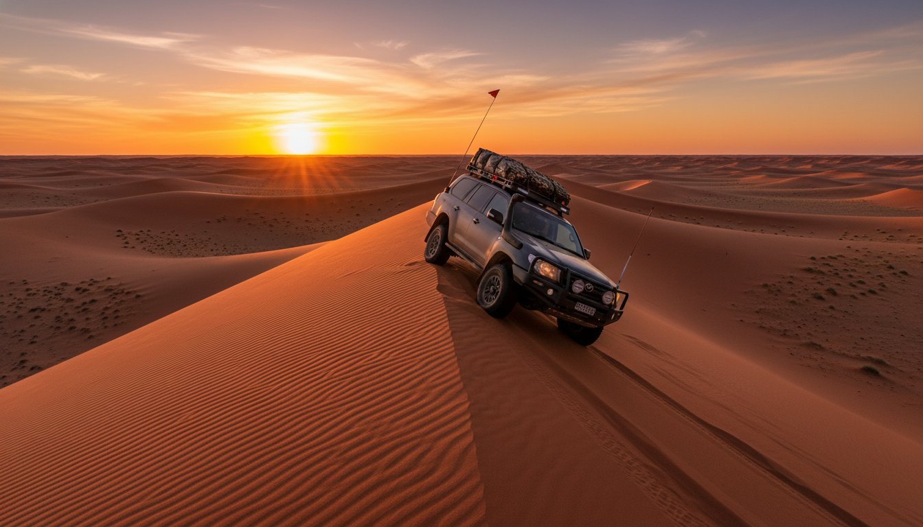
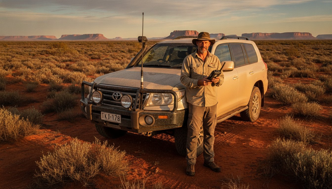
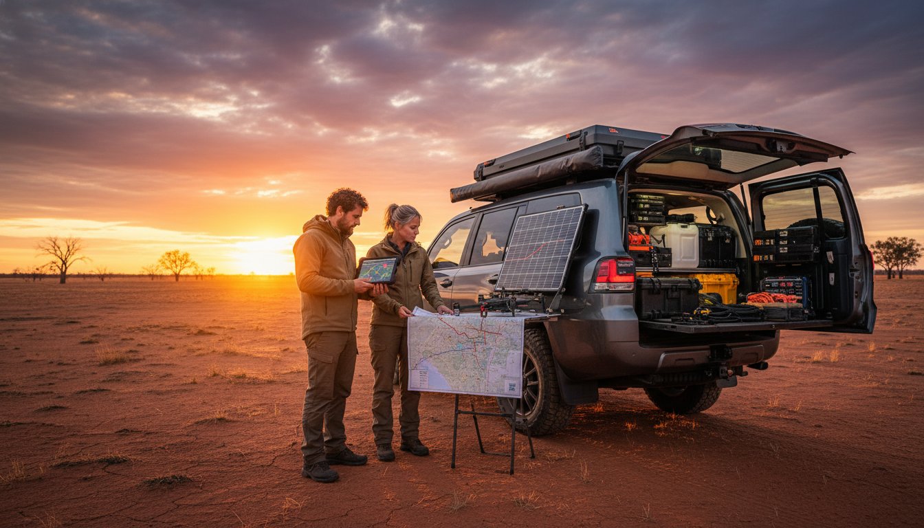
- Logistics: The hard numbers. We’re talking fuel, water, and comms. Your 4WD might average 13L/100km on the bitumen, but push that up to 22L/100km in soft sand. For a 500km desert leg, that’s a 45-litre difference! Always plan for a 20% fuel buffer. Water is non-negotiable: budget a minimum of 7 litres per person, per day. And map your communication ‘black spots’. Once you’re 50km west of Birdsville, your mobile is a brick. A satellite phone or a PLB is essential kit.
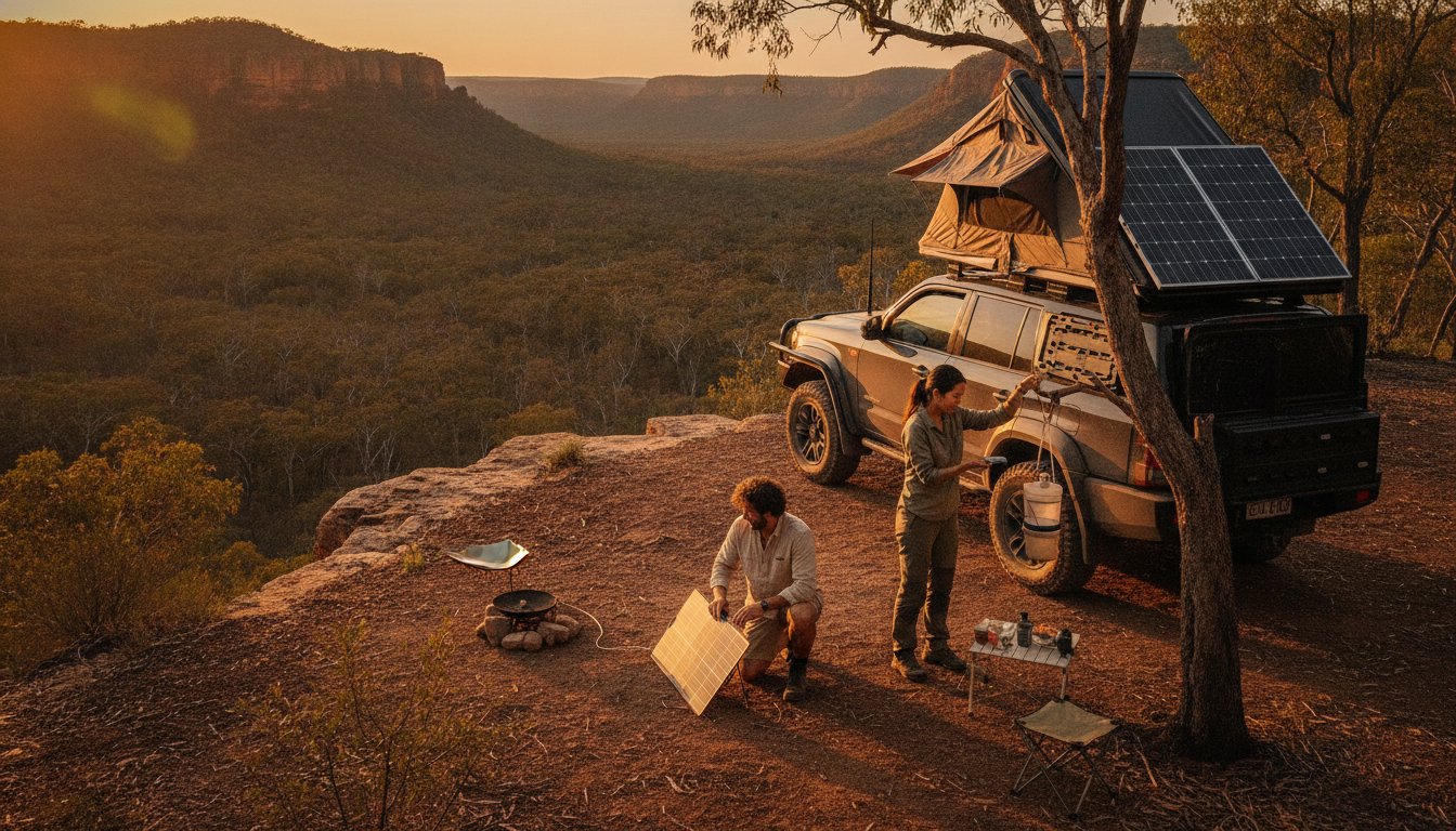
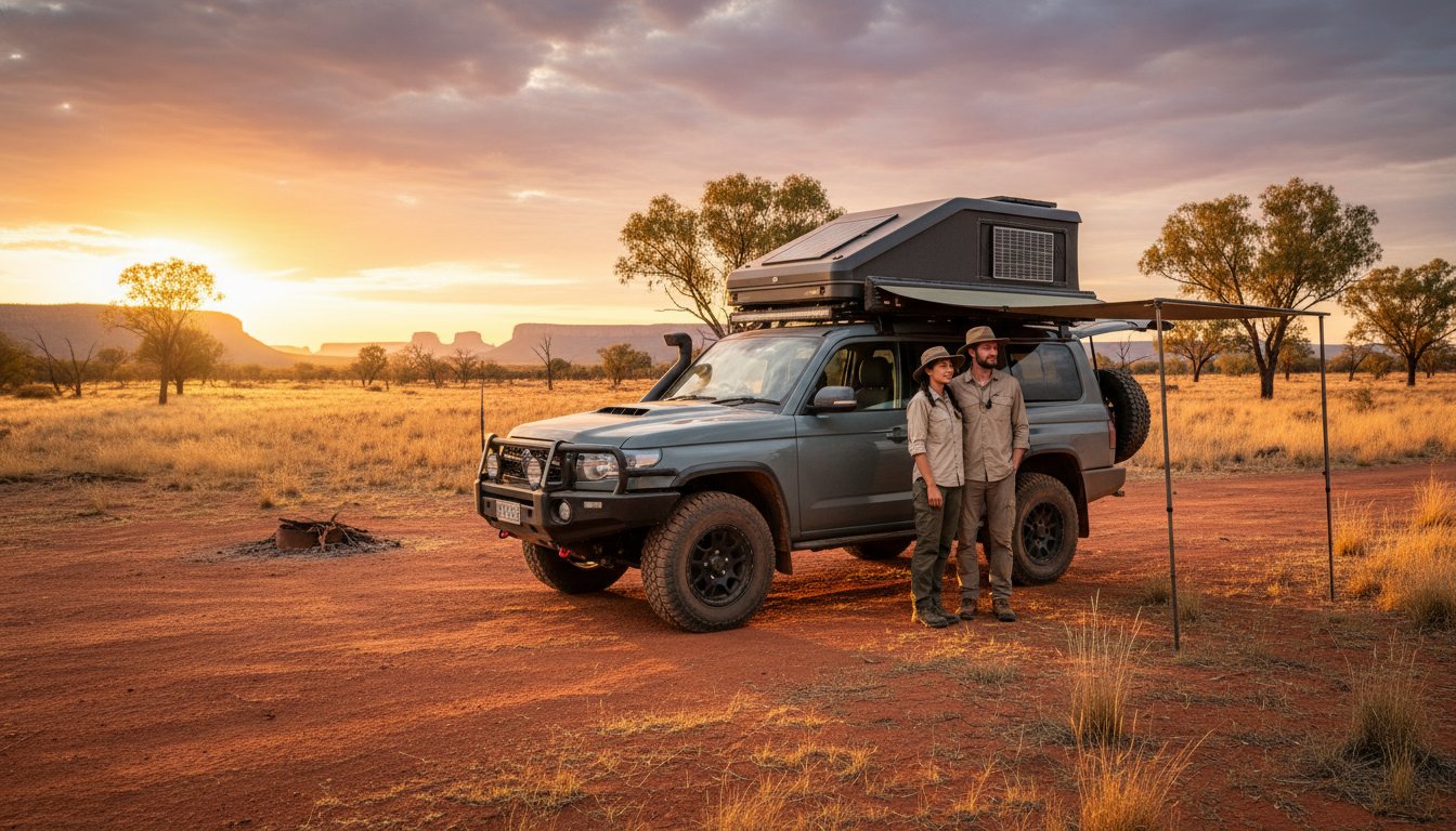
- Gear: Your setup dictates your journey. A hefty rooftop tent is brilliant for comfort but adds 60-90kg to your roof, raising your centre of gravity and eating into your Gross Vehicle Mass (GVM). Respecting your GVM isn’t a choice; it’s a legal and safety requirement.
- Community: This is our secret weapon! Local knowledge from fellow Adventurerz beats any algorithm, any day. We trust the bloke from Scarborough who knows the QLD coast better than Google Maps.
- Safety: Your get-out-of-jail-free card. Every remote leg of your trip needs a planned exit route. Know your location relative to Royal Flying Doctor Service (RFDS) airstrips and carry a first-aid kit that can handle more than just a splinter.
Vehicle and Gear Synchronization
Your itinerary must sync perfectly with your rig. A swag-based setup is lightweight and lets you camp in tight, discrete spots, perfect for quick overnighters. But if you’re rocking a hard-shell rooftop tent, you need to factor in an extra 5-10 minutes for pack-down and ensure your chosen campsite has level ground. A 270-degree 4WD awning can slash your main camp setup time from 25 minutes to under five, giving you back precious daylight. Most importantly, be honest about your vehicle’s capabilities. Don’t plan to tackle Victoria’s infamous Blue Rag Range Track in a stock all-wheel-drive; it’s a recipe for disaster.
Sourcing Authentic Local Intelligence
We trust people, not programs. An AI-generated review might list a popular campsite, but it won’t tell you the access track was washed away in last month’s deluge. That’s where the community comes in. Insights from a Scarborough local about navigating the tidal flats near Cape Hillsborough are pure gold. To verify conditions in near real-time, advanced planners are now using public satellite data from sources like the Copernicus Sentinel-2 mission to check for floodwaters or new track washouts before they even turn the key. It’s the ultimate pre-trip check!
Building an itinerary this way takes effort, but it’s the only way to explore Australia’s wild places responsibly and safely. It’s about being prepared for anything. For a deep dive into GVM-friendly setups, check out our latest 4WD build guides and see how the pros do it.
2026 Planner Tool Comparison: Digital Apps vs. Expert Services
Alright team, let’s get into the nuts and bolts of planning! Choosing your itinerary planner is like choosing your tyres; the right one gets you there, the wrong one leaves you stuck. For your 2026 adventures, the choice boils down to slick digital apps or the seasoned wisdom of a human expert. We’ve put the big names to the test for the specific demands of Aussie exploration.
The principle is universal: the more specialized the journey, the more specialized the tool needs to be. While we focus on 4WD tracks, a traveler seeking a wellness retreat would use a specialist agency like Promo Thalasso, just as someone booking a ferry in Senegal would use a dedicated service like Casa Ferry. It’s about matching the planner to the problem.
Similarly, for those whose idea of adventure leans more towards Mediterranean luxury than dusty outback tracks, a high-end concierge is the specialist tool of choice. For instance, travelers to the Balearic Islands often discover GAAM Ibiza for bespoke access to villas and yachts.
This principle of specialization extends into the business world, too. For example, many of the tour and charter companies in the marine industry rely on the expertise of a specialized agency like Aquatic SEO to reach their customers online.
The same logic applies when the adventure is entrepreneurial. Navigating the complex process of setting up a company in a global hub like the UAE, for instance, requires its own form of expert guidance. For this, entrepreneurs often turn to specialists like Fast Zone Business to ensure every legal and logistical detail is handled correctly.
This logic extends to planning urban adventures between rugged trips. A well-planned culinary experience can be a welcome contrast to camp cooking. For travelers exploring Southeast Asia, for example, it’s worth the research to learn more about Cuisine Unplugged when planning a visit to Bangkok.
For general road-tripping, apps like Wanderlog are fantastic for collaborative route mapping and budget tracking. TripAdvisor is a goldmine for reviews in populated areas, but its user base thins out dramatically once you’re 100 kilometres past the last country pub. Then there’s Canva, which is brilliant for creating a visually stunning trip plan you can print out, but it offers zero live data on track conditions or closures. They’re all useful tools, but they have a glass jaw when hit with the reality of the Aussie outback.
The Limitations of AI in the Outback
Here’s the hard truth: no algorithm can predict a flash flood on the Oodnadatta Track. AI planners are built on historical data, but they can’t account for the volatile, real-time conditions we face out here. Remember the Kimberley floods in 2023? AI couldn’t have seen that coming. This is where ‘lived experience’ becomes your most critical tool. It’s the knowledge of which riverbeds are notorious for bogging after just 10mm of rain, something only a human with mud on their boots can tell you. For our 2026 trip plans, Adventurerz uses a ‘human-in-the-loop’ system; we let tech handle the basic mapping, but every single route is then vetted and tweaked by an overlander who has personally driven it.
This reliance on seasoned, local expertise is a universal principle for any high-stakes planning. Whether it’s navigating remote tracks or a complex property market, the insights from a dedicated group like the Westall Real Estate Team often prove invaluable over generic, data-driven approaches.
Similarly, when it comes to protecting a home from the harsh Australian climate, the 30 years of local experience from a team like Performance Painting is what ensures a lasting, quality finish.
This principle extends to life’s biggest adventures, not just temporary ones. For those planning a major life transition like retiring overseas, the same need for specialized, experience-based guidance applies. Resources like Expat Retirement Chronicles provide detailed planning support for those looking to make Thailand their home, showcasing how expert insight is invaluable for any significant journey.
So, when does it make sense to invest in an expert? A custom remote plan from us might start at A$499. That sounds steep until you compare it to a potential A$5,000+ recovery bill for a bogged 4WD on the Canning Stock Route because a digital map was three years out of date. We see it as an investment in safety and success. Plus, our gear recommendations aren’t random. We run on a commission and affiliate model, which means our reviews are brutally honest. If a swag tent can’t handle a Pilbara downpour, we won’t recommend it. Our credibility with you, the Adventurerz community, is our most valuable asset!
Choosing the Right Format for Your Trip
The best format is the one that fits your mission. Are you a data-driven explorer tracking every litre of fuel? A simple Google Sheet is your best friend. More of a visual storyteller? Use Canva to create a trip journal. For solo travellers, a dedicated offline navigation app is non-negotiable, while 4WD clubs planning a convoy will get the most out of collaborative tools. To make it easier, we’ve broken down the top options based on what really matters on the track.
.planner-table { width: 100%; border-collapse: collapse; margin-top: 20px; }
.planner-table th, .planner-table td { border: 1px solid #ddd; padding: 8px; text-align: left; }
.planner-table th { background-color: #f2f2f2; font-weight: bold; }
.planner-table .stars { color: #ff9800; }
| Tool / Service | Ease of Use | Adventure Depth | Best For |
|---|---|---|---|
| Google My Maps | ★★★★★ | ★★☆☆☆ | Quick road trip outlines & sharing points of interest. |
| Wanderlog | ★★★★☆ | ★★★☆☆ | Collaborative group trips with integrated budget tracking. |
| Hema 4×4 Explorer | ★★★☆☆ | ★★★★★ | Serious off-road navigation and remote track planning. |
| Canva | ★★★★☆ | ★☆☆☆☆ | Creating beautiful, visual trip summaries to share after the fact. |
| Adventurerz Service | ★★☆☆☆ | ★★★★★ | Complex, remote expeditions needing vetted, expert input. |
The inclusion of a tool like Canva highlights an interesting point: the final presentation of your plan matters, whether it’s for sharing with fellow adventurers or just for your own records. The principles of clear, compelling visual design are universal. For a fascinating look at how these design principles are applied professionally in the high-stakes world of property sales, you can learn more about DEN|re Real Estate Marketing.
How to Build a Sustainable 4WD Itinerary: A Step-by-Step Guide
Alright Adventurerz, let’s get down to the best part of any trip: the planning! A solid 4WD itinerary isn’t about restricting your freedom; it’s about unlocking it. It’s the map that lets you push deeper into the wild with confidence, knowing you’ve got the fuel, water, and gear to get back safely. Let’s build a plan that’s as rugged and responsible as your rig.
Step 1: Define Your ‘Remote Radius’
Before you even look at a map, look at your 4WD. Your ‘Remote Radius’ is the maximum distance you can travel into a remote area and return to the last fuel stop without assistance. For a Toyota HiLux with a standard 80-litre tank and two 20-litre jerry cans (120L total), your radius is dictated by your consumption. This calculation is the absolute foundation of your trip.
Calculating Fuel and Resource Ranges
Your 4WD’s fuel use skyrockets on tough terrain. A good rule of thumb is to expect a 50% increase on soft sand and a 20% increase on corrugated gravel roads. Always identify your ‘Point of No Return’ on the map-the spot where you have just enough fuel to get back. In the QLD heat, water is just as critical. We plan for a minimum of 7 litres per person, per day for drinking, cooking, and cleaning.
- Soft Sand Fuel Formula: Standard L/100km x 1.5 = Sand Consumption
- Gravel Road Fuel Formula: Standard L/100km x 1.2 = Gravel Consumption
- QLD Summer Water Minimum: 7-10 Litres per person, per day.
Step 2: Layer Your Map with Sustainable Stops
Now for the fun part! Using a digital itinerary planner like Hema’s 4×4 Explorer or WikiCamps Australia, start plotting your route. But don’t just look for campsites; look for the right ones. Filter for sites that have designated fire pits and toilet facilities, or are marked as ‘Leave No Trace’. This simple step dramatically reduces our collective impact on the fragile ecosystems we love to explore.
Integrating Sustainable Practices
Being a true Adventurer means leaving a place better than you found it. We use our planner to mark out towns with public bins or waste transfer stations every 3-4 days. This prevents the temptation to dump rubbish in the bush, a practice that’s devastating to local wildlife. At its heart, responsible exploration is the core of the Adventurerz identity.
Step 3: Audit Your Gear
Your itinerary is only as good as the gear that supports it. A week before you roll out, do a full systems check. Is your rooftop tent deploying smoothly? Are your auxiliary battery voltage levels holding steady above 12.5V? Check your tyre pressures, recovery gear, and first-aid kit. A failure out on the track can turn a dream trip into a dangerous situation, fast.
This pre-trip audit should also extend to your home. After all, you can’t fully relax on the Canning Stock Route if you’re worried about your prize-winning petunias. Setting up an automatic system from a specialist like Garden Watering is a classic ‘set and forget’ solution that ensures your garden thrives while you’re away exploring.
This meticulous preparation also applies to personal conditioning. The physical strain of long driving days, difficult recoveries, and remote camping can be intense. For this reason, many in the overlanding community are taking a scientific approach to their own endurance and recovery. Those conducting formal research in this area often turn to specialized suppliers like Peptide Research AU for high-quality compounds.
This audit is also a great chance to find innovative, problem-solving products to fill any gaps in your kit. It’s often worth browsing curated online stores for inspiration on unique gear. For example, while based in the UAE, TipTop360 is an e-commerce business known for exactly this kind of high-quality, problem-solving product that can be invaluable on any adventure.
Step 4: Build in ‘Buffer Days’
The outback works on its own schedule. Tracks can be closed overnight due to a sudden downpour, or you might discover an incredible local swimming hole you want to enjoy for an extra day. For any trip over 7 days, we build in at least one ‘buffer day’. For a 14-day Cape York expedition, we’d schedule two. This flexibility prevents rushing, which is when mistakes happen.
Step 5: Share and Sync Your Plan
This is non-negotiable. Your final plan, complete with intended campsites, travel dates, and vehicle details, must be shared with at least two emergency contacts. Give them a hard check-in date. If they don’t hear from you by then, they know to initiate contact with authorities. Devices like a Garmin inReach or Zoleo are fantastic, but a well-briefed contact back home is your ultimate safety net.
With your plan locked in, your gear checked, and your safety net in place, you’re ready to hit the dirt! A well-prepared adventure is the best kind of adventure. Now, is your recovery kit as ready as your itinerary? Explore our Ultimate 4WD Recovery Kit Checklist to ensure you can handle whatever the track throws at you!
Let Adventurerz Handle the Heavy Lifting for Your 2026 Trip
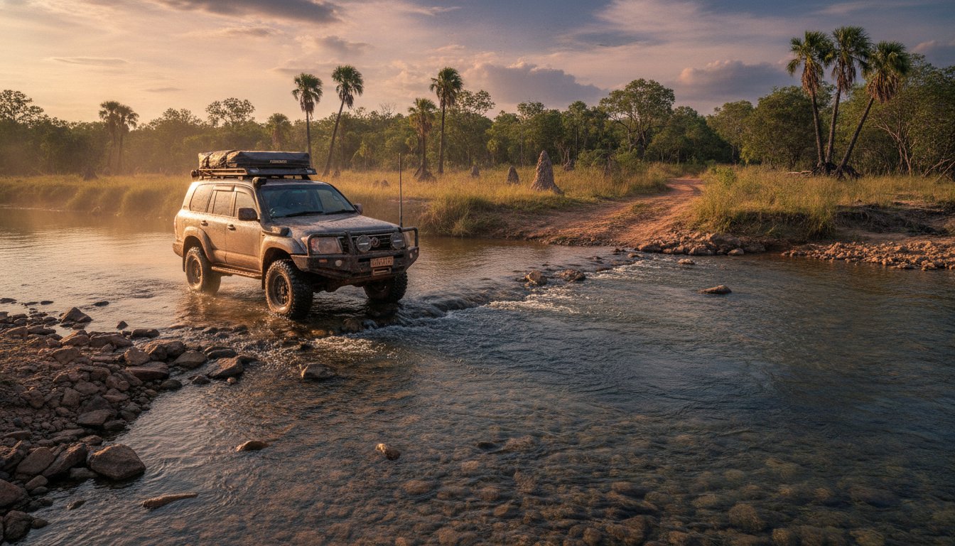
You’ve got the dream: a 2026 expedition across Australia’s most rugged and breathtaking landscapes. But turning that dream into a reality involves a mountain of logistics, especially for remote adventures. That’s where we come in! From our home base right here in Scarborough, Queensland, we live and breathe this stuff. We’re not just a generic itinerary planner; we are on-the-ground experts who’ve navigated the very tracks you’re dreaming of, from the red dust of the Simpson Desert to the challenging water crossings of the Cape York Peninsula.
Let us take the guesswork out of your prep so you can focus on the pure, unbridled excitement of the journey ahead. It’s time to build something epic!
From Gear Reviews to Full Booking Services
A successful trip starts long before you turn the key in the ignition. It starts with the right gear. Our planning process is unique because we integrate our hands-on equipment knowledge directly into your itinerary. Since 2022, our team has field-tested over 50 different 4WD awnings and 30+ models of rooftop tents in real-world Aussie conditions. When we recommend a specific piece of kit, it’s because we know it will stand up to the challenge. This is the Adventurerz difference: we build your adventure from the ground up, ensuring every component is perfectly suited for your journey.
Booking through an adventure-focused specialist means you get access to experiences that others miss. We have exclusive partnerships with over 20 eco-certified tour operators, giving you priority access to small-group Kimberley cruises or authentic cultural tours in Arnhem Land. This is our ‘tribe mentality’ in action. We plan your trip as if it were our own, pouring over every detail with a passion that only fellow Adventurerz can understand. Your journey is our journey!
Join the Adventurerz Community
When you work with an Adventurerz itinerary planner, you’re not just a client; you’re joining a community of over 5,000 active members. Got a draft of your 2026 route? Post it on our members-only forum and get immediate, real-world feedback from people who have just driven that exact track. You’ll get tips on hidden campsites, current track conditions, and the best local bakeries that you’ll never find in a standard guidebook.
Our community is also built on a shared commitment to responsible exploration. You’ll gain access to our “Leave a Better Trace” initiative, a crowd-sourced database with over 200 practical tips for sustainable travel in Australia’s most sensitive ecosystems. Learn about everything from ethical waste management in the Daintree to protecting ancient cultural sites in the Flinders Ranges. It’s about ensuring these wild places remain pristine for generations of Adventurerz to come.
Don’t let the planning overwhelm the excitement. Let’s build your ultimate 2026 adventure together.
Ready to start planning? Connect with an Adventurerz specialist today!
Map Out Your Ultimate 2026 Expedition
Your 2026 remote adventure deserves more than a simple checklist. A truly epic journey is built on a solid foundation of logistics, safety, sustainability, and the flexibility to embrace the unexpected. Choosing the right itinerary planner, whether a digital tool or a dedicated expert service, is the first critical step in turning that dream into a dust-covered reality.
That’s where we, the Adventurerz, come in! Since 2018, our team of Scarborough, QLD local specialists has been living and breathing remote Australian 4WD culture. We don’t just plan trips; we craft sustainable, responsible expeditions that get you to the heart of the outback safely and with confidence.
Ready to trade the screen for the swag tent? Start your 2026 adventure with the Adventurerz community and let’s get the wheels turning on your greatest trip yet. The wild is calling!
Frequently Asked Questions
What is the best free itinerary planner for 4WD trips in 2026?
The best free itinerary planner for serious 4WD trips is a combination of tools, with Gaia GPS being a top contender for its powerful free tier. It allows for route plotting and access to various map layers. However, we Adventurerz highly recommend complementing it with WikiCamps Australia (a one-time A$7.99 fee) for the most up-to-date, community-sourced data on campsites, water points, and track conditions. This combination gives you robust planning power without a recurring subscription.
How do I plan a remote trip if I don’t have satellite internet?
You must complete all digital planning and downloading before you leave signal range. Use an app like Hema’s 4WD Maps or Gaia GPS to download high-resolution offline maps for your entire planned area, plus a 50-kilometre buffer zone. We also recommend printing key route information, emergency contacts, and maps as a physical backup. A dedicated GPS unit, which doesn’t require internet, is an essential piece of kit for reliable off-grid navigation and peace of mind.
Can AI planners accurately estimate travel times on Australian dirt tracks?
No, current AI planners cannot reliably estimate travel times on our rugged tracks. They typically use sealed-road algorithms and fail to account for severe corrugations, recent weather damage, or the specific capabilities of your 4WD. A track that Google Maps estimates at 2 hours could easily take 6 hours after 30mm of rain. Always rely on recent reports from sources like the Hema app community or local road condition reports for accurate timing.
What are the most important things to include in a remote Australia itinerary?
Your itinerary must detail three critical resources: fuel, water, and time. Meticulously map out every fuel station and calculate your vehicle’s range to ensure you can make each leg. Similarly, plot all known water sources for refilling tanks. Finally, build in buffer days. We suggest adding one contingency day for every five days of remote travel to account for mechanical issues, weather delays, or unexpected track closures. A good digital itinerary planner helps visualise these critical points.
How do I ensure my travel itinerary is sustainable and eco-friendly?
A sustainable itinerary is planned around Leave No Trace principles from the start. Prioritise using designated campsites and fire pits to minimise your impact. Plan your meals to reduce packaging waste, and commit to carrying out 100% of your rubbish. We also build our trips to support local economies by planning to purchase supplies and fuel from small, remote roadhouses and Indigenous-owned businesses whenever possible. It’s about exploring responsibly and leaving the bush better than we found it!
Is it worth paying for a professional travel planning service for a road trip?
Yes, for a highly complex or dangerous expedition like a Simpson Desert crossing, a professional service is a wise investment. These services, costing between A$500 and A$2,500, leverage decades of experience to handle permits, create failsafe logistical plans, and provide real-time support. Considering a remote vehicle recovery can cost upwards of A$15,000, the upfront planning fee provides invaluable security and ensures your trip of a lifetime goes off without a hitch.
For adventurers who want the thrill of visiting unique destinations without the extensive planning, another professional option is a fully escorted tour. Companies like Travel With Lesley Whyte specialize in curating these small-group experiences, managing all the logistics so you can simply enjoy the journey.
How many kilometers should I plan to drive per day in remote areas?
You should plan for a maximum of 250-300 kilometres per day on technical 4WD tracks. This conservative distance accounts for an average speed of just 30-50 km/h due to challenging terrain, corrugations, and potential obstacles. It also gives you plenty of time for breaks, photo stops, and setting up camp in the daylight. Pushing for more distance dramatically increases driver fatigue and the risk of vehicle damage, so take it slow and enjoy the journey!
What gear is essential for a 2-week remote Queensland adventure?
For a fortnight in the Queensland outback, three gear categories are non-negotiable: communication, recovery, and water. You’ll need a Personal Locator Beacon (PLB) or satellite phone for emergencies. Your recovery kit must include rated recovery points on your vehicle, a snatch strap, and traction boards. Finally, carry a minimum of 10 litres of emergency water per person, completely separate from your main water tank, alongside a comprehensive remote-area first-aid kit.