In 2026, a GPS is no longer just a digital map; it’s your primary safety tether to civilization when you’re deep in the Australian bush. We’ve all felt that sudden prickle of anxiety when the mobile bars vanish and the track ahead starts to blur into the scrub. Relying on standard smartphone apps in the remote outback is a gamble that most of us aren’t willing to take. That’s why finding the best off-road GPS Australia 2026 has to offer is the first step in any responsible adventure. It’s about more than just finding a destination; it’s about ensuring we can always find our way home while protecting the pristine environments we love to explore.
We understand the frustration of inaccurate digital maps and the genuine fear of being unable to call for help in an emergency. You want high-resolution topographical maps that show every ridge and gully, along with reliable satellite-based SOS features that work where towers don’t exist. In this guide, we’ll dive into the top-rated off-road navigation systems for 2026, including units that integrate seamlessly with your other 4WD gear like roof top tents and awnings. You’ll discover which devices offer the best durability and satellite connectivity to keep you moving with confidence across our rugged landscapes.
Key Takeaways
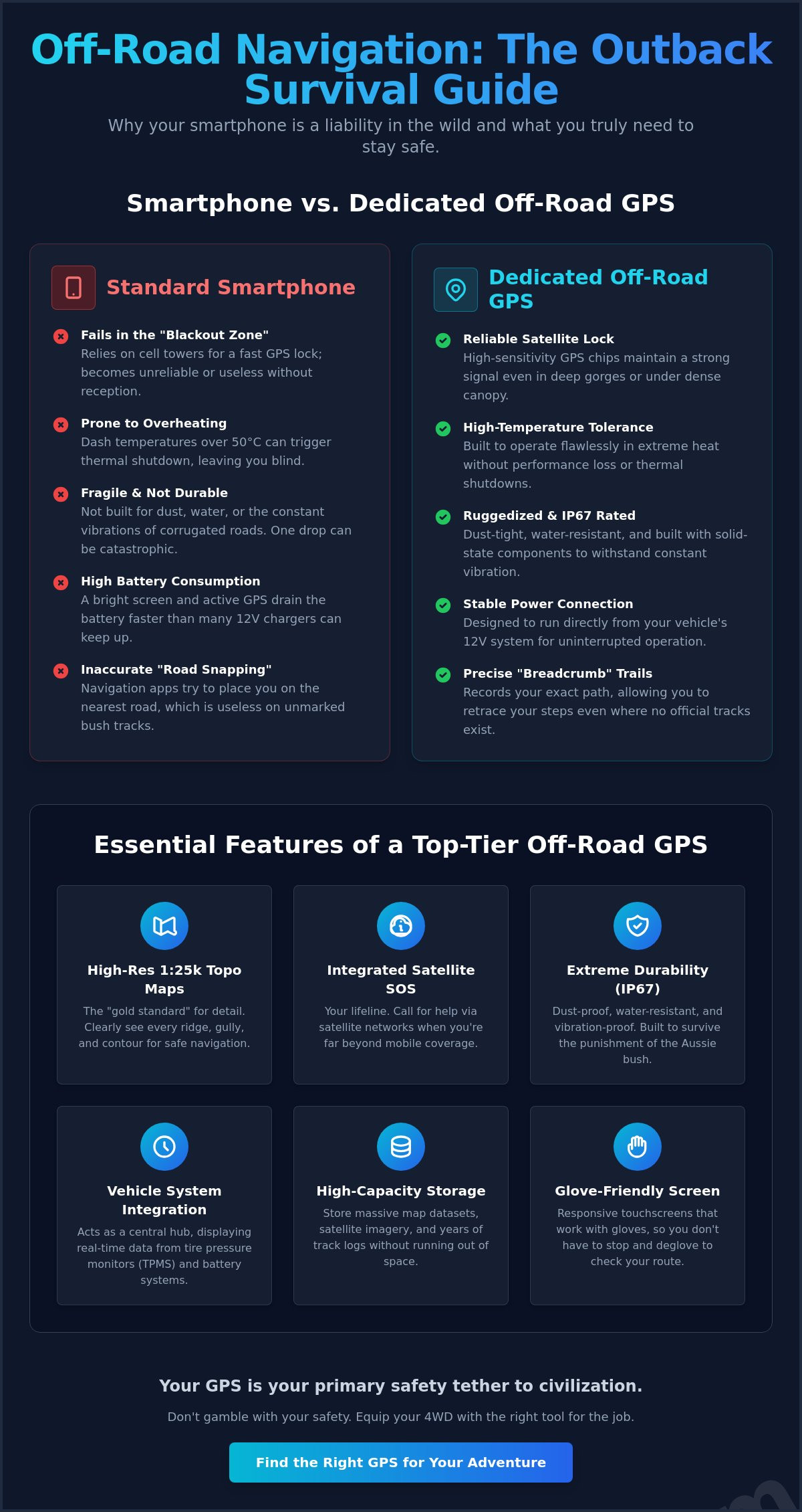
- Understand why standard smartphone apps fail in the “Blackout Zone” and why a dedicated, ruggedized GPS chip is essential for remote reliability.
- Explore our expert reviews of the best off-road GPS Australia 2026, including the Garmin Tread 2 and Hema HX-2+, to find the perfect fit for your 4WD setup.
- Learn to prioritize high-resolution 1:25k topographical mapping and integrated satellite SOS features for ultimate peace of mind in the scrub.
- Discover how to integrate your navigation tools into a broader adventure ecosystem that respects our environment by keeping you on existing tracks.
Why Your Smartphone Fails in the Australian Outback
We’ve all been there. You’re cruising down a remote track, the red dust is kicking up, and suddenly your phone screen goes black with a “Temperature Warning.” It’s a classic Aussie outback moment that reminds us why consumer tech often falls short. While your smartphone is a marvel of modern engineering, it isn’t designed to survive the harsh realities of our most rugged tracks. To find the best off-road GPS Australia 2026 offers, we have to understand why a dedicated unit is a non-negotiable part of our kit.
An off-road GPS is a ruggedized powerhouse pre-loaded with high-resolution vector and raster topographical maps. Unlike your phone, which often relies on cell tower assistance to find your location quickly, these units utilize the full power of the Global Positioning System (GPS) with high-sensitivity antennas. This allows us to maintain a lock in conditions that would leave a mobile device spinning its wheels.
Phones frequently struggle in what we call the “Blackout Zone.” This happens when the lack of a dedicated GPS chip causes your position to drift or disappear entirely once you lose mobile reception. Standard navigation apps also use road-following algorithms that try to “snap” your position to the nearest gazetted road. In the bush, we need track-recording breadcrumbs. These show exactly where we’ve been and where we’re heading, even if there hasn’t been a mapped road in that area for decades.
Then there’s the heat. The Australian summer sun beating through a 4WD windshield can easily push dash temperatures past 50 degrees Celsius. Smartphones usually trigger a thermal shutdown to protect their internal batteries, leaving you blind exactly when you need navigation most. Dedicated units are built to thrive in these high-ambient temperatures without skipping a beat.
The Limitations of Offline Phone Apps
Keeping a phone’s screen on at full brightness while constantly pinging satellites drains the battery faster than most 12V chargers can keep up. We also find that smartphone antennas struggle under heavy tree canopy or in deep gorges like those found in the Kimberley. Relying on a multi-purpose device is a gamble. If you drop your phone and the screen cracks, you’ve lost your maps, your camera, and your emergency communication all at once.
Hardware Durability: Dust, Vibration, and Heat
Dedicated units are built for the grind. Most are IP67-rated, meaning they’re dust-tight and can handle a dunk in a creek crossing. They use solid-state components designed to withstand the relentless vibration of corrugated roads that would eventually rattle a standard phone’s internal connectors loose. Finding the best off-road GPS Australia 2026 for your rig means choosing hardware that survives the journey. These units also feature glove-friendly touchscreens, so we don’t have to deglove every time we want to zoom in on a topo map while setting up our 4wd awnings or planning the next day’s route from our roof top tents.
Essential Features of a Top-Tier Off-Road GPS in 2026
What makes the best off-road GPS Australia 2026 stand out isn’t just a bigger screen; it’s the intelligence under the hood. We’re looking for units that act as a central hub for our entire vehicle. Modern systems now integrate wirelessly with Tire Pressure Monitoring Systems (TPMS) and battery monitors, giving us a real-time health check of our rig while we navigate. This level of integration ensures we’re never caught off guard by a slow leak or a dying auxiliary battery while deep in the Gibson Desert. Understanding how GPS technology works helps us appreciate the precision required to track these metrics alongside our physical location with surgical accuracy.
Precision matters when the track disappears into the spinifex. A 1:25k topographical map is the gold standard for 2026, offering the granular detail needed to distinguish between a traversable ridge and a dangerous vertical drop. To store these massive data sets alongside years of high-detail track logs, high-capacity internal storage is essential. We shouldn’t have to delete old adventures just to make room for new ones. These units allow us to cache detailed satellite imagery and raster maps, providing a visual reference that vector maps alone sometimes miss.
The 2026 Satellite Connectivity Standard
Australian-Specific Data and POIs
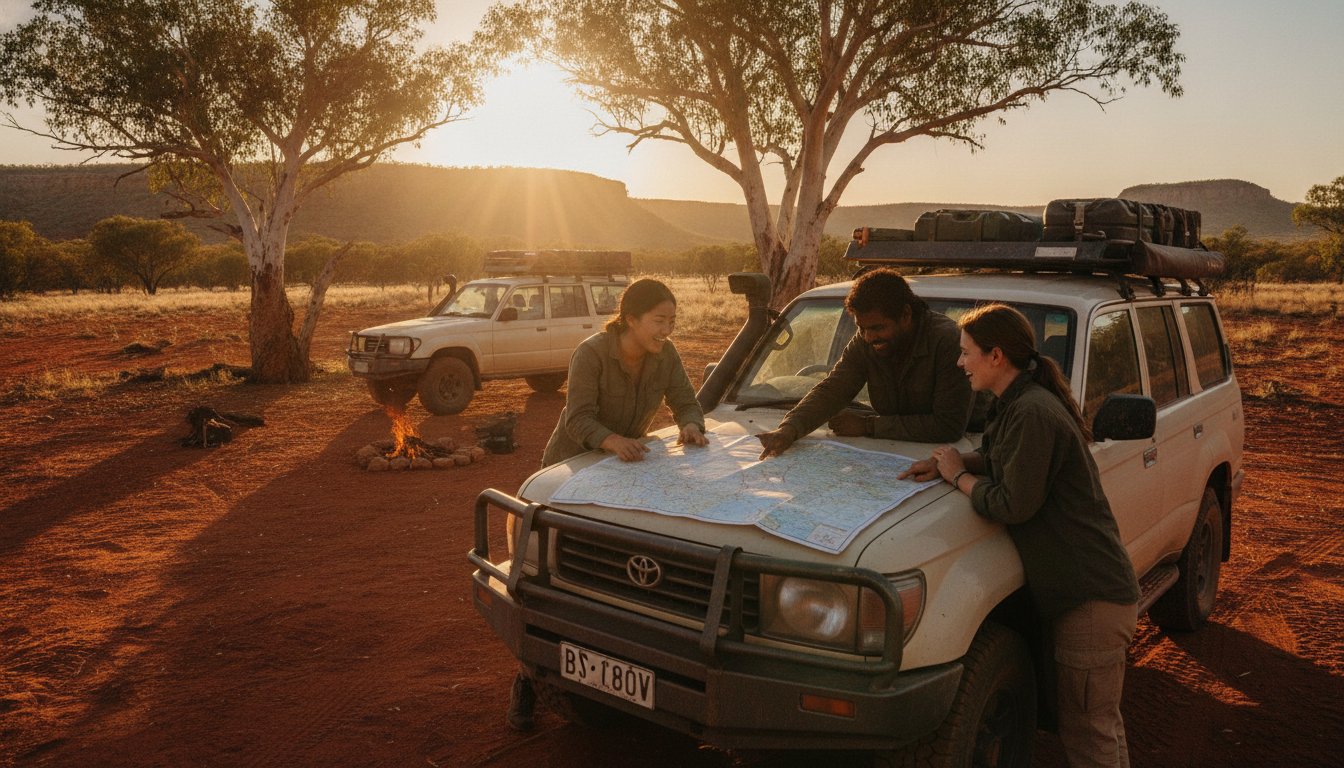
Generic global maps don’t cut it in our unique backyard. We need units pre-loaded with Hema Maps or Geoscience Australia data that highlight remote fuel drops, bore water locations, and emergency airstrips. A Topographical Map is a detailed record of a land area, giving us a clear picture of elevation through contour lines and identifying the density of the surrounding scrub. Knowing where the next water source is can be the difference between a successful trip and a dangerous situation. While you’re planning your next remote trek, check out our latest 4wd awnings recommendations to ensure your camp setup is as reliable as your navigation gear.
The Top 5 Off-Road GPS Units for Australian Tracks in 2026
Choosing the right hardware is where the rubber meets the road. We’ve spent countless hours on the tracks testing these units to find the best off-road GPS Australia 2026 has for our community. It isn’t just about the price tag; it’s about how the device handles the relentless dust and corrugations of the Oodnadatta Track. We need gear that’s as hardy as the landscapes we explore, and these five options represent the pinnacle of current technology.
The Garmin Tread 2 – Overland Edition ($1,699.00 AUD) is currently the heavyweight champion of the rugged ecosystem. It’s built like a tank and features a high-sensitivity antenna that locks onto signals where others fail. If you prefer local expertise, the Hema HX-2+ ($779.00 AUD) remains a favorite for its unmatched database of over 690,000kms of tracks and 545,000km of unsealed roads. Its shift to vector mapping provides a level of detail that’s hard to beat for precise navigation.
For those who want to visualize the elevation before they climb, the Melbourne-based VMS 3DX offers superior 3D terrain rendering on a crisp 8-inch screen with 32GB of internal memory. If you’re looking for a cleaner cabin, the Polaris Maxx series provides an impressive in-dash integrated solution. It replaces your factory head unit with a system dedicated to the dirt, ensuring your maps are always part of the vehicle. Whether you choose a portable unit or an in-dash system depends on your vehicle’s setup and how often you swap between rigs.
Garmin vs. Hema: The Battle for the Dash
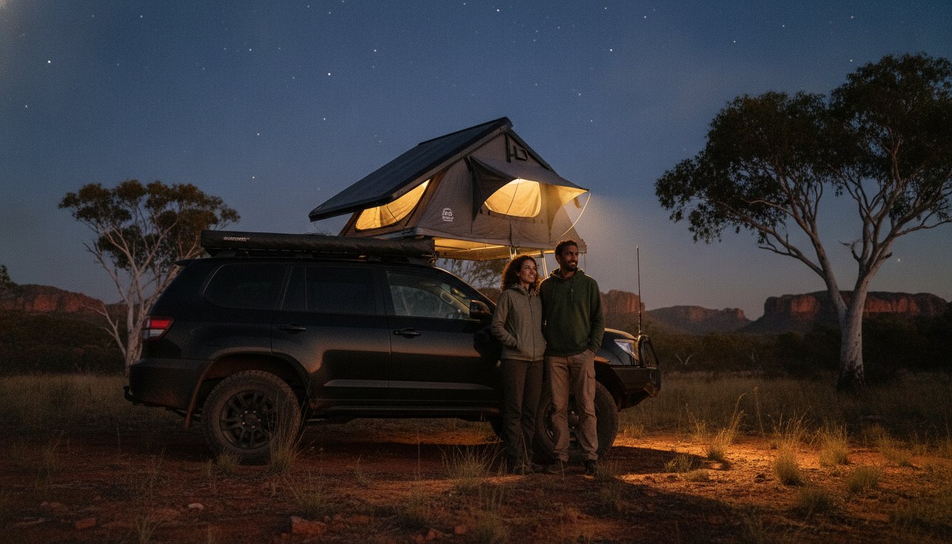
This is the age-old debate in our circles. Garmin wins on pure hardware reliability and global satellite connectivity. Hema, however, takes the prize for the most detailed Australian track data, including those obscure campsites only the locals know about. We find that Garmin is ideal for long-distance overlanding where durability is king. Hema is often better for weekending on tight, local tracks where map accuracy is vital. These units pair perfectly with our roof top tents, allowing us to navigate to the most remote sites and set up camp with total peace of mind.
Handheld Units for Hikers and Bikers
Not every adventure happens behind a steering wheel. For the bikers and hikers among us, the Garmin inReach Mini 2 ($679.00 AUD) and the Montana 700i offer incredible versatility. The smaller screens can be a challenge in high-glare Australian environments, but their portability is unmatched. These units undergo rigorous durability testing to ensure they can handle being handlebar-mounted on an adventure bike through a river crossing. They provide the same life-saving SOS features in a package that fits in your pocket, making them a vital tool for those who prefer to travel light.
How to Choose the Right Navigation System for Your 4WD Setup
Selecting the best off-road GPS Australia 2026 has to offer depends entirely on how we use our rigs. We need to look past the flashy marketing and assess our primary travel style. Are you a solo explorer who values solitude in the desert, or do you head out with a convoy of mates? For those of us who travel in packs, “Group Ride” features have become a 2026 essential. These systems allow us to track the real-time position of everyone in our party on the screen, even when the dust is so thick we can’t see the taillights of the vehicle in front.
We also have to consider the “screen-to-dash” ratio. While an 8-inch or 10-inch screen looks impressive in the showroom, it can dangerously obscure our view of the track in a smaller vehicle. We want a device that provides clear information at a glance without creating a blind spot. Evaluating your vehicle’s power and mounting capacity is equally vital. A heavy unit requires a sturdy mounting surface that won’t flex or rattle loose when the corrugations get serious.
Mounting and Power Solutions
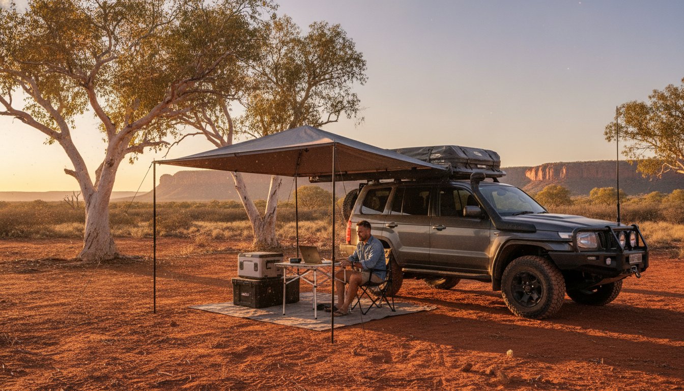
We swear by RAM mounts and vibration-dampening cradles for a reason. Standard suction cups often fail under the intense heat and constant jarring of outback travel. Hard-wiring your unit is almost always superior to using a 12V plug. This ensures your GPS doesn’t lose power or reboot exactly when you stall on a steep incline or navigate a tricky creek crossing. Proper positioning is key; we place our units so they remain visible and accessible even when our four wheel drive awnings are deployed at camp and we’re planning the next day’s leg in the shade.
Software Ecosystem and Map Updates
In 2026, “Lifetime Map Updates” are a non-negotiable requirement for any top-tier system. The outback is constantly changing, and having access to the latest track data ensures we aren’t following outdated routes that lead into dead ends or protected land. Ease of use is the other half of the battle. We look for units that allow us to plan detailed routes on a laptop or tablet at home and sync them wirelessly to the device in the driveway. To verify map currency before a major trip, navigate to the device’s system settings and cross-reference the installed map version date against the manufacturer’s latest release notes. Before you head out, make sure your accommodation is sorted by reading our roof top tents recommendations for the ultimate remote basecamp.
Beyond the Screen: Integrating GPS into Your Adventure Ecosystem
Even with the best off-road GPS Australia 2026 can provide, we must remember that technology is just one part of our toolkit. It’s a partner in our journey, not a replacement for fundamental bushcraft. We always carry a paper map backup. Electronics can fail, and batteries can die, but a physical map remains a reliable constant in the bush. Using our GPS correctly means more than just finding the next campsite; it’s about being responsible stewards of the land we love to explore. We use these tools to enhance our self-reliance, ensuring we’re prepared for the unexpected while minimizing our footprint on the environment.
Responsible navigation is a core value for our community. We stay on existing tracks to protect fragile ecosystems and respect the boundaries of private property and traditional lands. Straying off-road can cause long-term erosion and destroy native flora that takes decades to recover. By following the breadcrumbs on our screens, we ensure that the tracks remain open and accessible for the next generation of explorers. Our GPS logs aren’t just personal records; they’re data points that help us contribute back to the wider community by identifying track conditions and potential hazards.
Responsible Exploration and Track Ethics
We use our high-resolution topo layers to identify and avoid sensitive cultural sites and protected zones. Modern mapping software often includes these overlays, allowing us to plan routes that are both exciting and respectful of local heritage. Breadcrumbing is a vital safety habit. It ensures we can always retrace our steps if a track becomes impassable or if we need to return to a known point. When we encounter major washouts or unexpected track closures, we make a note of the coordinates. Reporting these changes to mapping authorities or sharing them within our community helps keep everyone safe and our maps accurate.
Planning Your Next Escape
Ready to map out your next big trip? Check out The Ultimate Adventure Travel Planner for expert tips on route mapping and remote preparation. We encourage you to share your 2026 track logs with the community once you return. It’s how we keep our collective knowledge fresh and help others find the best off-road GPS Australia 2026 routes for their own rigs. Before you head out, run through this final checklist:
- Update your GPS firmware and download the latest map versions.
- Sync your planned routes from your laptop to your device.
- Ensure your mounting hardware is tight and vibration-free.
- Pack your paper map backups and a handheld compass.
- Check that your roof top tents and 4wd awnings are secure for the transit.
Equip your rig with the right gear, respect the tracks, and get out there responsibly. The outback is waiting, and with the right navigation setup, we can explore it with total confidence!
Gear Up for Your Next Remote Escape
Mastering the outback requires more than just a sense of adventure; it demands the right technology to keep us safe and on track. We’ve seen how dedicated hardware beats a smartphone every time, especially when the heat rises and the corrugations get brutal. By prioritizing high-resolution topographical maps and integrated satellite communication, you’re investing in a safety tether that works even in the deepest “Blackout Zones.” Choosing the best off-road GPS Australia 2026 offers is about ensuring every member of our community returns home with stories worth sharing.
Our team has expert tested these units in the Simpson Desert to bring you community-vetted gear recommendations focused on sustainable and safe remote travel. Navigation is just the beginning of a well-prepared rig. Check out our expert reviews on 4WD gear to complete your rig! We’re here to guide you toward responsible exploration that protects our unique natural environments. The tracks are calling, and with the right setup, there’s no limit to where we can go together. See you out there!
Frequently Asked Questions
Do I need a subscription for an off-road GPS to work in Australia?
No, basic navigation and GPS tracking work entirely for free because the units connect directly to global satellite networks. You only need a paid subscription if you want to use premium features like two-way satellite messaging, live weather overlays, or integrated SOS emergency services. These plans are usually flexible, allowing us to activate them just for the months we’re actually out exploring the bush.
Can I use a tablet with an external GPS receiver instead of a dedicated unit?
You can use a tablet setup, but it rarely survives the rigors of a long-haul outback trek as well as a dedicated device. Consumer tablets lack the specialized thermal management and vibration resistance found in the best off-road GPS Australia 2026 models. While a tablet offers a large screen for camp planning, it often triggers a thermal shutdown on a hot dash or suffers from internal connector failure on corrugated roads.
Which off-road GPS has the best maps for the Simpson Desert?
The Hema HX-2+ is widely considered the gold standard for the Simpson Desert due to its extensive, locally-verified database of desert tracks. Hema Maps has mapped over 690,000kms of tracks across Australia, providing superior detail on dune crossings and remote fuel locations. The vector mapping on these newer units allows for much faster zooming and clearer detail when we’re navigating high-consequence desert terrain.
How do I update the maps on my Hema or Garmin device?
Most 2026 devices allow you to update maps directly via a stable Wi-Fi connection without needing to plug into a computer. For Garmin units, you can also use the Garmin Express software on a PC or Mac for larger, high-resolution map data transfers. We suggest checking for updates at least a week before your departure to ensure you have the most current track data and points of interest loaded for your journey.
Is a satellite communicator better than a PLB for remote travel?
A satellite communicator is better for non-life-threatening coordination, while a Personal Locator Beacon (PLB) is a dedicated emergency tool with a multi-year battery life. Communicators allow for two-way messaging, which helps us stay in touch with family or report a mechanical breakdown. However, a PLB is a regulated safety device that transmits a more powerful signal directly to search and rescue satellites during a life-and-death emergency.
What happens if my GPS screen breaks in the middle of a trip?
If your primary screen fails, you should immediately switch to your secondary navigation source, such as a handheld unit or your paper map backup. This is why we always emphasize carrying physical maps for every remote journey. We also recommend having your route pre-loaded onto a secondary device like a smartphone with offline maps as a temporary solution while you’re still in the scrub.
How much data does a 2026 off-road GPS use for satellite messaging?
Satellite messaging uses a tiny amount of data because it sends short bursts of text rather than high-bandwidth information. Each message is typically only a few hundred bytes, which is why these systems work so reliably even with a minimal satellite lock. You don’t need to worry about data usage in the traditional sense, though your specific service plan will determine how many messages you can send each month.
Can I load my own custom GPX files into these 2026 devices?
Yes, all top-tier 2026 devices support the import of custom GPX files for route planning and track sharing. This allows us to download tracks from the community or plan intricate routes on third-party software before syncing them to our dash units. It’s a fantastic way to follow the exact path of experienced explorers who have already vetted the track conditions for the best off-road GPS Australia 2026 experience.